
Jackson Neighbors Block Sources
Records around one Jackson address answer different questions. The parcel map is best for the immediate geography, assessment data helps separate situs and mailing information, and deeds show recorded ownership events. Voter information is handled through the release rules of the elections custodian. Directories and historic studies add older context. Each source is useful for its own date and purpose, so the block should be read as a set of dated records instead of a single household list.
| Block source | What it can show near an address | Jackson access route |
|---|---|---|
| Jackson County Parcel Viewer | Adjacent parcels, owner, legal and tax context, map selection | Public viewer with map tools |
| City assessment record | Recorded owner, mailing and situs clues, permits, transfer history, PRE | City property-search link or assessor counter |
| Register of Deeds index | Grantor, grantee, deed, mortgage, and legal-description trail | Deeds Online or Register counter |
| Released voter record | Public registration fields for a defined street or precinct | Clerk or elections FOIA request |
| Permit or code record | Address work, responsible party, or compliance trail | Community Development or FOIA |
| Polk or Bresser directory | Historical address, head of household, phone, and move clues | Jackson District Library or Library of Michigan |
| Historic district materials | Area boundaries, surveys, and selected property studies | City historic-resources materials |
A parcel owner may be an individual, estate, trust, business, lender, government body, or an absent owner. The mapped situs is the physical parcel. The tax mailing address is where correspondence goes. Neither field proves that every person at an address is a neighbor, and the difference should be recorded before any comparison is made.
Jackson GIS Block Controls
The Jackson County Parcel Viewer is the most direct official tool for the block around an address. Search for the address or zoom to it, then use INFO after selecting a parcel. The viewer supports a blue selected-parcel outline, map clicking, shift-drag selection, Ctrl-click addition or removal, MORE and VIEW ALL, CSV export, mailing-label PDFs, parcel reports, printable maps, and a distance buffer measured in feet.
Selection method matters. Shift-drag is useful for a visible run of parcels. Ctrl-click adjusts that group. BUFFER selects parcels within a specified distance but cannot be used at the same time as multi-selection. Parcel lines are not survey grade and may not match aerial or other layers precisely. A recorded plat, survey, or deed is the better source for a legal boundary question.
The Jackson County Parcel Viewer displays the map controls used to examine neighboring parcels.
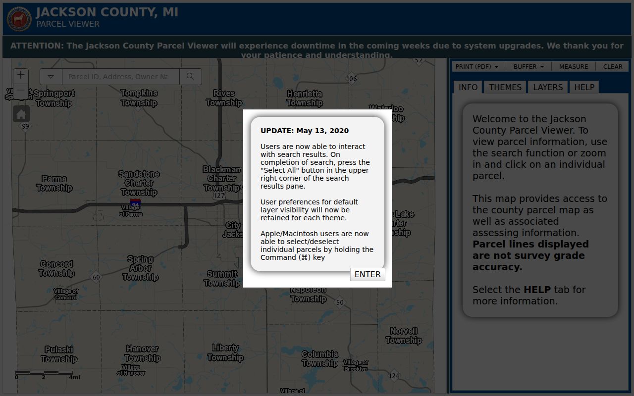
The image shows why map selection is a parcel operation. An export or mailing-label PDF describes selected parcels, not a roster of Jackson neighbors or a statement of relationships between them.
Parcel tip. Save the map date, selected PINs, and whether a selection crossed a street or municipal boundary before comparing the results with another record.
Map Jackson Neighbors by Parcel
Use a narrow, repeatable process for immediate Jackson neighbors. First anchor the address to a parcel. Then identify only the parcels that share a boundary or sit directly across the street. Read owner, mailing, situs, and legal-description fields as separate facts. Move to the deed index only after saving the parcel key, because legal descriptions and PINs survive a street-name change better than a typed street string.
- Find the confirmed address in the Parcel Viewer and select it. Save the address, parcel or PIN, and legal-description fragment shown in INFO.
- Click a touching parcel or the parcel across the street. Use shift-drag for a visible block, or Ctrl-click to remove unrelated property from a selected group.
- Compare the city assessment record for the situs, mailing address, transfer history, and principal-residence exemption. Treat the exemption as cautious owner-occupancy evidence, not a list of occupants.
- Search the recorded owner as grantee in the Register of Deeds and compare the legal description. Follow an earlier grantor only when the description matches the same parcel or lot.
- For a full named-street chain rather than an immediate block, use the Jackson by-street directory and keep the parcel-level results separate.
The county describes its online grantor-grantee search as extending from 1964 or 1965 back to 1800, depending on the county page. Verify that transition when searching. If the web index fails, the Register of Deeds counter can search by legal description and provide the older deed-book or microfilm fallback.
Jackson Neighbors Map Myth
Myth: selecting a Jackson block produces a resident list. The viewer produces parcel information. A named owner can be different from the person living at the situs address, and a common mailing address can belong to an agent, a business office, or another property. A selected group may also include a vacant lot, condominium unit, tax-exempt property, institution, or commercial parcel.
Use the map as a way to locate records, not to infer household membership. A title event proves that an instrument was recorded. A permit identifies a project participant. A directory can place a historical head of household at an address. Those records can be compared, but none supports a claim about every person who may have been present on the block at a given time.
Note: A legal description or PIN is the safest bridge when Jackson street names, directions, or numbers do not match across records.
Jackson Neighbors Voter Requests
Michigan makes voter-registration records public through FOIA, but public access has field-level limits. MCL 168.509gg withholds driver-license and state-ID numbers, birth month and day, phone, email, registration-agency identity, and declination information. The public status tool, the Michigan Voter Information Center, did not expose a street-wide result during the research. It should not be treated as a block roster.
For an existing block or precinct record, ask the city, county, or state elections custodian for a defined street segment, side of street, precinct, date range, needed fields, file type, and redactions. Michigan FOIA gives the public body five business days to respond, with one written extension of up to ten business days. The request is for an existing record, not a request for the office to identify neighbors or make relationship judgments.
Jackson Neighborhood Association Gap
Jackson’s neighborhood-association materials document a recognition framework, not a verified current membership directory. The city’s 2021 ordinance encouraged chartered associations, communication with members and the city, a democratic decision process, and positions that show how votes were reached. Research did not locate a current official city roster, association boundaries, member list, umbrella organization, or join contacts. Those missing details should be requested from the city or the relevant association, not guessed from a map.
City recognition framework
Jackson’s neighborhood-association ordinance is the documented starting point for recognition and communication rules.
Current roster status
No current official roster, boundary list, or private member directory was located in the research. Use City Clerk, Community Development, public meeting records, or a published association notice for follow-up.
Public meeting agendas, historic-commission materials, zoning records, and neighborhood-association communications can identify speakers, petitioners, officers, or addresses for a particular matter. They do not establish that every association member lives on the block. Voluntarily published church, club, or historic newsletters may add context, but a private social-media list is not a substitute for an official or published source.
Jackson Neighbors Historic Context
Older Jackson blocks have records that predate the parcel viewer. The city’s Historic District Resources identify studies for places including Under the Oaks, Allen School, Withington and Cooley, and 317 West Wesley. Under the Oaks is west of downtown and is bounded in part by South West Avenue, West Morrell, First, Steward, and Jackson High School. These materials describe area context and selected property studies, not current household membership.
For a past block, pair the current parcel with the nearest dated source. The 1893 Jackson Sanborn map has 25 sheets and can show earlier building footprints or uses. Polk and Bresser directory entries can associate an address with a historical household or phone record. A deed, old map, and directory entry may all be correct, yet refer to different dates and different facts.
Jackson Neighbor Source Comparison
Official records and commercial neighbor-lookup products are different categories. The official route identifies the custodian, record date, fields, and access limits. A commercial compilation can combine purchased and public data, but it may mix similar names, retain an old address, and leave its sources unclear. Start with the official record whenever a conclusion needs checking or correction.
| Record approach | What is clear | What still needs caution |
|---|---|---|
| Official parcel, deed, or voter release | Custodian, record type, date, and statutory limits are identifiable. | Owner is not always occupant; released fields can be incomplete or redacted. |
| Official permit, historic study, or directory | The record’s historical purpose and date can be checked with the agency or library. | It may name an applicant, an older household, or a selected property only. |
| Commercial compilation category | May offer a quick lead for further verification. | Source, age, identity match, and update practice can be uncertain; it is not a custodian record. |
When an official record appears wrong, contact City Assessing, Equalization or GIS, the Register of Deeds, the clerk, or the court that keeps it. A correction request should identify the parcel, case, license, or record reference rather than asking for a broad search of a person.
Jackson Neighbor Privacy Limits
Renters, household members, utility and delivery customers, protected voters, and DMV address holders remain outside an ordinary parcel or block search. Michigan’s Address Confidentiality Program can provide a qualifying person with a substitute address and mail forwarding. An absent result or substitute address is a protection, not proof that a person has left the area. Do not publish combined name-and-address lists or use a parcel export to monitor a person.
Michigan’s stalking statute, MCL 750.411h, makes repeated unwanted conduct a serious legal issue. Public records do not authorize following, approaching, entering property, repeated calls or messages, or other unconsented contact. For records that are public but unavailable online, Michigan FOIA, 1976 PA 442, MCL 15.231-.246, provides a written-request path to the public body holding an existing record.
Lawful use. Use Jackson neighbor records for personal, lawful purposes such as understanding a block, family history, civic research, or checking property context. Never use them to stalk, harass, intimidate, or target another person.